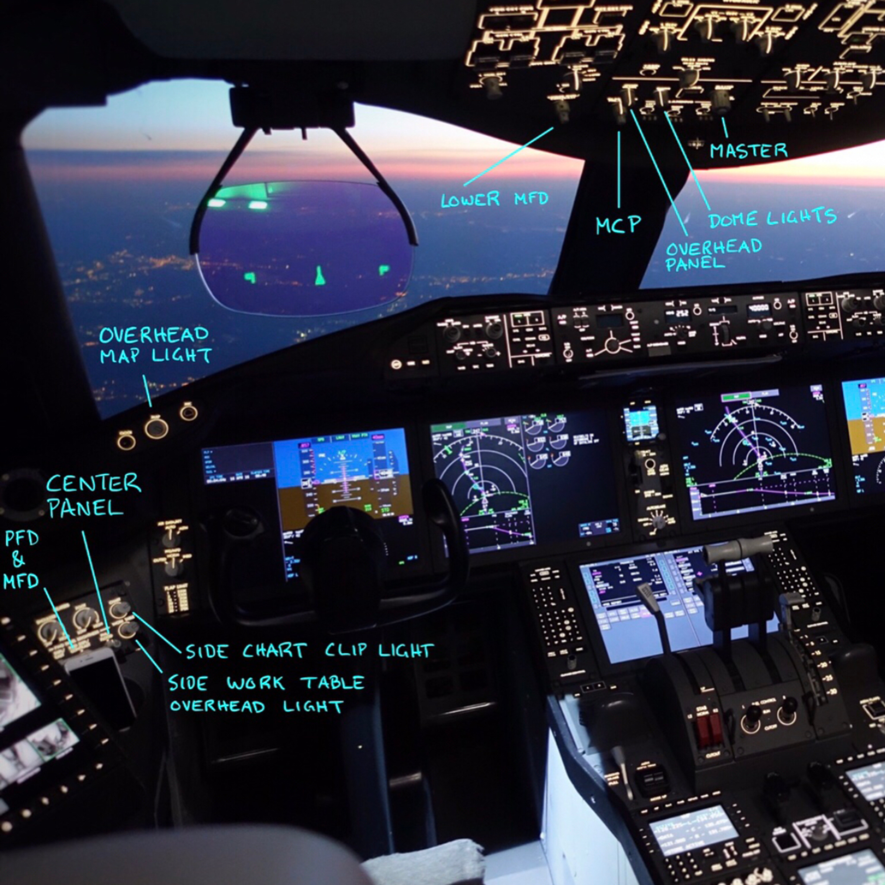
Non-ILS approaches on the Boeing 787 require strict adherence to minimum RMP values, navigation authorizations, and equipment standards. RMP 0.3 is the baseline for GPS-based RNAV approaches, with RMP 0.1 allowing for lower minimums in specific cases. Autopilot and flight director must remain engaged under low visibility or ceiling conditions, and GPS RAIM prediction is mandatory for RMP values below 0.3 to ensure satellite coverage along the approach path. Temperature corrections are required at non-US airports when actual temperatures fall below published limits. A go-around is mandated if navigation deviations exceed thresholds, visual contact is not made, or equipment fails. For ILS and non-ILS approaches, DDA is always used instead of MDA, calculated by adding 50 feet. IAN must be used on final approach segments for precise glide path tracking. Final approach path accuracy is verified through cross-checks of altitude, glide slope, and lateral position. The crew must maintain a stabilized approach, disengage autopilot only when visual contact is confirmed, and follow go-around criteria in case of failure. Special authorization for Category 1 and 2 approaches includes HUD, autoland, and specific lighting requirements. Pilot coordination is critical, especially during descent and flare, with both pilots monitoring instruments and visual cues. All procedures emphasize safety margins, equipment redundancy, and strict compliance with approach minima and environmental conditions.
"Instrument Approaches Boeing 787" Approach landing go-around, Normal Procedures Chapter 6,
Non-ILS Section 4, a few quick highlights to remember about Non-ILS Approaches General,
do not use flight level change on final approach below 1000 feet AFE. Non-ILS Approaches are defined
as RNAV, RMP, RMP, AR, Authorized. Authorization required RNAV, GPS, GNSS, localizer,
localizer back course, LDA, SDF, VOR, NDB. Use of HUD during approaches, both pilots will use
the HUD if operative. During all approaches, when visibility is less than 4000 RVR, 1200 meters,
or 3/4 mile visibility. Use of the autopilot flight director during non-ILS approaches,
the autopilot and flight director for the pilot flying must be operable and used when
the reported ceiling is less than 1000 feet AGL, or the visibility is less than 3 statured miles,
10,000 correction, 1,000 and 3, and all RNAV, RMP, RMP, AR approaches below RMP 0.3.
Navigation display, vertical situation display, the matte mode and VSD must be used for all non-ILS
procedures. VNAV, temperature compensation, airplane flight manual. The Boeing 787 has a
uncompensated barrel VNAV system. At non-US airports, VNAV instrument approach operations are
prohibited unless the altitude corrections are applied to all published procedure
altitudes when the temperature at the landing elevation is below the minimum temperature on the
approach chart or below zero degree Celsius. If no temperature, minimum temperature is on the
approach chart. US RNAV approach procedures that have a published cold temperature limit for
LNAV-NAV minimum for uncompensated barrel VNAV systems, LNAV-NAV, not authorized below a given
temperature, use LNAV plus 50 feet for the DDA if below the published temperature.
RNAV GPS GNSS approach requirements. The minimum RNAV GPS GNSS approach is RMP 0.3. RNAV
RMP-RMP-AR, authorized authorization required, approach requirements, the minimum RNAV-RMP-RMP-AR
approach authorized is RMP 0.1. The maximum airspeed on the final approach segment of a RNAV-RMP-RMP-AR
approach is 180 knots. RNAV-RMP-AR approach temperature limitations. If the actual temperature is
outside the specified temperature range depicted on the approach chart, RNAV-RMP-AR approaches
are not authored. A note about RMP 0.3 values approaches below. This RMP value required GPS RAIM
prediction. The airport-specific receiver autonomous integrity monitoring RAIM prediction
is a process conducted by dispatch to determine if there will be sufficient GPS satellite
coverage along the approach path for a specific arrival time/window. It is determined there will be
insufficient satellites at arrival. Dispatch may delay the flight until sufficient satellite
coverage is available or plan the flight based on non-RNAV procedures. VMC conditions.
Approaches in VMC conditions may be flown to a RMP value as low as 0.1 without GPS RAIM prediction
message on the flight plan/dispatch release. An example might be a visual approach backed up by
RNAV-RMP-AR procedure. IMC conditions. RMP 0.3 or greater approaches in IMC conditions may
be flown to an RMP value as low as 0.3 provided there is not a GPS RAIM prediction message
restricting RNAV operations on the flight plan/dispatch release. RMP less than 0.3 approaches in IMC
conditions with A. RMP less than 0.3 require a GPS RAIM prediction message on the flight plan/dispatch
release. Use of integrated approach navigation IAN. IAN should be used in place of LNAV and VNAV
on the final segment of non-ILS approaches. For IAN FMC based approaches a proper series of
legs and weight points describing the approach route including an appropriate vertical path or
glide path GP angle must appear on the legs page. A quick note about non-ILS approach
minimum decision altitude/derived decision altitude DA and DDA respectively. All non-ILS approaches
will be flown to either a decision altitude or a derived decision altitude. When using a published
MDA a DDA must be used for minima. Remember DDA is MDA plus 50 feet memory hint DA don't add MDA
must do arithmetic non-ILS approach memory aid LVSAFE live safe L select or verify LNAV
V select or verify VNAV S indicated airspeed selector push as needed set speed
A MCP altitude set minimum F FMA check for engaged modes E approach switch push engage
non-ILS approach requirements quick reference general refer to the ops advisory pages -7 in
JEPS FD pro for authorized RNAV RMP RMP AR approaches visibility required use approach chart
category D minimums temperature if the airport temperature exceeds the approach temperature limitations
RNAV RMP RMP AR approaches not authorized RNAV GPS RMP use LNAV DDA MDA plus 50 feet
minimums wind till when max 15 knots note may be further limited by performance requirements
with less than 4,000 RVR 1200 meters or 3/4 mile crosswind limitation max 15 knots minimum aircraft
equipment RNAV RMP RMP AR approaches to PFD MFD displays mini map may be used to autopilot to
IRU to GPS no nav single GPS message to FMC no single FMC message to rad out no
single source rad out message to flight director no single source flight director message GPS
no ground proc system or terrain position message no LNAV inertial system message no
nav air data system message RNAV GPS RMP approaches one FMC one CDU one GPS
VOR or NDB approaches VOR one VOR is required NDB refer to the ops advisory pages in GEPS FD pro
for authorized NDB approaches using RNAV substitute approach procedures autopilot auto breaks autopilot
and flight director for the pilot flying must be operable and used when reported ceiling
is less than 1000 feet AGR or visibility is less than 3st batch of miles, 1003 and all
RNAV RMP AR approaches below RMP 0.3. Autopilot may be disengaged when runway visual
references are established with less than 4000 RBR, 1200 meters or 3/4 mile, autobricks
3 minimum if operable, if operative required. Non-ILS approach procedures prior to commencing
approach select the appropriate procedure from the current FMC navigation database, verify
proper sequence of waypoints in vertical path or glide path GP angle on the legs page.
For localizer approaches with the glide slope out or unreliable glide slope prompt, the
GS prompt is selected off, approach ref page. To ensure the FMC generated glide path
is flown, if an RMP value is specified in the Approach Chart Minimums block, on RMP Prague
4-4 review RAM availability predictions, if required, verify approach RMP 6 left or manually
enter RMP 2 left, Barrow Minimums selector set Minimums. Initial maneuvering, appropriate
roll mode, appropriate pitch mode, after cleared for the approach, verify final approach
navigation source is tuned and identified localizer based approaches.
Live safe LNAV select or verify, VNAV select or verify, indicated air speed selector push
as needed set speed, MCP altitude set Minimums, FMA checked for engaged modes, verify LNAV
is engaged prior to arming approach mode, approach switch push engage, 300 feet below
mist approach altitude or GP capture whichever occurs first, mode control altitude set mist approach
altitude, passing the final approach fix, final approach path glide path intercept, verify
crossing altitude is within 100 feet of charted altitude, passing the final approach fix, final
approach point glide path intercept, VNAV path or glide path as required, verify crossing
altitude is within 100 feet of charted final approach fix altitude, at Minimums if required
to continue below Minimums are satisfied, continue approach and disengage autopilot if
engage no lower than 135 feet AGL and maintain stabilized approach to touchdown.
If requirements to continue below Minimums are not satisfied, accomplish mist approach.
Non-ILS approach go around requirements, a go around is required if the following conditions
occur and a visual approach and landing cannot be accomplished, final approach fix crossing
altitude is not within 100 feet of charted final approach fix, final approach point altitude,
LNAV unable RMP ICAST message is displayed, verify position scratch path message displayed,
an amber lateral deviation indication occurs or HUD NPS deviation pointer, blank or deviation
bars become hollow and blank after the initial approach fix inbound, an amber vertical deviation
indication occurs or vertical track or exceeds plus or minus 75 feet or HUD deviation
bars become hollow and blank after final approach fix or glide path intercept, localizer
shows full deflection on final approach in FMC, correction IMC if the navigation instrument
shows significant disagreement and visual contact with the runway has not been established,
focal failure of PFD/MFD displays, single FMC message displays, caution a go around on
a RNRNAV RMPAR approach requires strict adherence to the mist approach lateral track, a go
around from a curved path requires the crew to ensure the aircraft remains on the depicted
ramp track, note if mist approach is coded on legs page ensure LNAV is engaged when
passing 400 feet HL autopilot use is recommended for the mist approach, ILS approaches, normal
procedures chapter 6 section 7, ILS category 1 ILS approach requirements decision altitude
minimum of 200 feet HAT height above threshold visibility approaches may be hand flown chart
minimums minimum RVR allowed 3/4 or 4,000 1200 meters touchdown zone 4,000 5/8 or 3,000 900 meters
touchdown zone 3,000 1/2 or 2,400 750 meters touchdown zone 2,400 1800 550 meters touchdown
zone 1800 RVR takes precedence over prevailing visibility if RVR is report transmissometer controlling
touchdown zone mid substitution okay advisory mid rollout and far end wind tailwind max 15 knots
note may be further limited by performance requirements with less than 4,000 RVR 1200 meter
or 3/4 mile crosswind max 15 knots autopilot auto breaks with less than 4,000 RVR 1200 meter
or 3/4 mile visibility autopilot recommended auto breaks 3 minimum if operative lighting
category 1 charted minimum 3/4 or 4,000 1200 meter approach the lights not required touchdown
zone centerline lights centerline or runway markings required runway edge lights edge lights
night required HIRL night or day with RVR minimums 5/8 or 3,900 meters mouse RR Salazar approach
lights required centerline or runway markings required edge lights night HIRL night or day
with RVR minimum 1/2 or 2400 750 meters mouse R Salazar LSF 1 or 2 or high intensity airport
lighting system required touchdown zone centerline lights centerline or runway markings required runway
edge lights high intensity runway lighting required 1800 or 550 meters mouse R Salazar ALSF 1 and 2 or
HIALS approach lights required touchdown zone centerline lights touchdown zone lights and centerline
lights required runway edge lights HIRL required note category 1 ILS approach with 1800 RVR minimums
to runways without touchdown zone centerline lights must be flown with flight director coupled
to autopilot or FP HUD or DA or MAP unless adequate visual reference with the runway environment
or establish that allow the safe continuation to a land category 1 ILS approach crew coordination
procedures at approximately 100 feet above decision altitude pilot flying when advised that visual
references are in sight confirm requirements to descend below DA or satisfied complete
approach and landing when visual contact with the runway is established maintain the glide path
to the flare do not duck under the glide path pilot monitoring should expand the instrument scan
to include outside visual cues when approaching DA call out visual references when in sight direct
primary attention to monitoring instruments category 1 ILS approach go around requirements when on
final approach in IMC and either localizer or glide slope indicator show full deflection when the
navigation instruments show significant disagreement and visual contact with the runway has not been made
Prior to decision altitude, any of the required aircraft or ground equipment fails at decision
altitude requirements to continue the approach below DA far 121.651 have not been met.
Below DA, a reduction in visual references occurs when which prevents the pilot flying
from safely continuing the approach in landing. The captain determines that the landing cannot
be safely accomplished within the touchdown zone.
Raw data ILS, no flight director, ILS course deviation is displayed on the PFD HUD.
The localizer course deviation scale on the primary flight display HUD will remain normal
scale during the approach and not change to expanded scale. Begin the turn to the inbound
localizer heading at the first movement of the localizer pointer.
After course intercept, the track line and readout on the ND may be used to assist in applying
proper drift correction and maintaining desired course. Large bank angles will rarely be required
while tracking inbound on the localizer. Use 5 to 10 degrees angle of bank.
Local Authorization Cat 1, Special Authorization Cat 2, Cat 2, Approach Requirements, Decision
Height, Use, Published, R/Visibility Requirements, Special Authorization Cat 1, Flying, Pilot,
HUD, and Autoland Require, Chart Minimums, 1400 feet, 450 meters, Minimum RVR allowed,
Touchdown Zone 1400 feet, Number, Required, Reports, Touchdown Zone, Controlling,
Controlling, Touchdown Zone, No Substitution, Advisory, Mid, Rollout, and Farah, Special
Authorization Cat 2, Category 2, Autoland Required below 1800 RVR, Charted Minimum 1400 feet, 450
meters, Minimum RVR allowed, Touchdown Zone 1400 feet, Mid 600 feet, Rollout 300 feet,
Required Number, Reports, Touchdown Zone, Controlling, Controlling, Touchdown Zone, No Substitution,
Controlling if Reporting, Mid, and Rollout, Advisory, Farah, and Charted Minimum 1200 feet,
450 meters, Minimum RVR allowed, Touchdown Zone 1200, Mid 600, Rollout 300, Required
Number, Reports, Touchdown Zone, and Rollout, Controlling, Touchdown Zone, No Substitution,
Controlling if Reporting, Mid, Rollout, Advisory, Farah, and, If needed to obtain the required
number of RVR reports, the far end may be substituted for the missing rollout, and if it so
is controlled.
Charted Minimum 1000 feet, 300 meters, Minimum RVR allowed, Touchdown Zone 1000, Mid 600,
Rollout 300, Required Number, Reports, Touchdown Zone, and Rollout, Controlling, Touchdown
Zone, No Substitution, Controlling if Reporting, Mid, and Rollout, Advisory, Farah, and,
Farah, and, May be substituted if missing rollout, and if so it is controlling.
Note, if RO is unavailable, Mid or Farah, and, May be substituted, if Farah, and is used
must be 300 RVR or greater.
When components headwind max 25 knots tailwind max 15 knots may be further limited by performance
requirements, crosswind 15 knots.
Wait, Dash 8, Autoland not authorized above 380,000 pounds, Dash 9, Autoland not authorized
over 425,000 pounds.
Runway.
Category 2 runway must have a localizer that is identified as being "unusable" inside
the runway through "correction" must not have, landing flaps, flaps 20, 25, or 30.
Autobrakes, Autobrakes 3 Minimum, if operative.
Minimum Aircraft Equipment, below 1500 feet are a Land 2 or Land 3, enunciated on both
PFDs or HUDs.
Special authorization, Cat 1, HUD is required.
Special authorization, Cat 1, Flying Pilot, HUD and Autoland required.
Minimum, 1400 feet, 450 meters.
Malazar, Salazar, ALSF1/2 or HAHLS.
Touchdown zone lights and centerline lights required.
Edge lights, high intensity runway lighting.
For special authorization, Cat 2 approaches, Autoland required, 1200 feet, 350 meters.
ALSF1/2, HAHLS, Salazar or Malazar sequence flashing lights not required.
Touchdown zone lights and/or centerline lights may be in operative.
Edge lights, high intensity runway lighting system.
Category 2, Autoland required.
1600 feet, 500 meters.
ALSF2, HAHLS, Sequence flashing lights not required.
High intensity runway lighting system.
1400 feet, 450 meters.
High intensity runway lighting.
1600 feet, 350 meters.
10,000 feet, 300 meters, ALSF2, HAHLS, Sequence flashing lights not required.
Touchdown zone lights and/or centerline lights must be operative.
Special Authorization Cat 1, Special Authorization Cat 2, Cat 2 approach go around requirements.
If a navigation radio or flight instrument failure which will affect the ability to safely
complete the approach occurs in instrument conditions, when on an ALSF2 approach in instrument
conditions and either localizer and/or glide slope indicator shows full deflection, when
the navigation instruments show significant disagreement and visual contact with a runway
has not been made.
Below 300 feet are a, if satisfactory tracking performance is not maintained, failure of required
aircraft or ground equipment prior to DH, autopilot or auto throttle disengages.
If the AFDS status enunciation downgrades below minimum required for approach, add or
below 200 feet a master caution light and oral signal.
The captain determines that a landing cannot be safely accomplished within the touchdown
zone.
Special Authorization Cat 1, Special Authorization Cat 2, Cat 2 Summary.
Minimum RVR, Special Authorization Cat 1, 1400 feet, 450 meters, AFDS status enunciation,
land 2 or land 3 required, approach minimums, Special Authorization Cat 1, with DH, alert
height, none, 1600 feet, 1400 feet, 1200 feet, 1000 feet, AFDS status enunciation, land
2 or land 3 required, SA Cat 2, Cat 2 with DH, alert height, none.
Equery 3, ILS Approach Requirements Decision height, land 2, 50 feet, land 3, none,
unlessed, public, alert height required for Cat 3, land 3, unless a DH is published, 100
feet, radio, altimeter, radio minimums, zero, visibility requirements for a Cat 3 approach.
Cat 3, land 2, Chartered Minimum, 700 feet, 200 meters, Minimum RVR allowed, touchdown
on 700 mid 700 roll out three.
600 feet 175 meters touch down zone 600 mid 600 rollout 300 300 feet 75 meters touch down
zone 600 mid 400 rollout 300 required number of reports for LAN 2 touch down zone +1 controlling
controlling touch down zone no substitution controlling if reporting mid and rollout advisory
far end category 3 LAN 3 700 feet 200 meters touch down zone 700 mid 700 rollout 300 600
feet 175 meters touch down zone 600 mid 600 rollout 300 300 feet 75 meters touch down
zone 300 mid 300 rollout 300 required number of reports any 2 controlling controlling if
reporting touch down zone mid and rollout advisory far end notes touch down zone and mid RFR
RVR reports must be no lower than the approach chart minimums example for an approach with
700 RVR the minimums are 700 700 300 if the approach chart minimums are lower than this
tables minimums then the table minimums apply note if needed to obtain the required number
of RVR reports the far end may be substituted for the missing rollout and if so is controlling
wind components headwind max 25 knots tailwind max 15 knots may further be limited by performance
requirements crosswind 15 knots wait dash 8 auto land not authorized over 380 thousand
pounds dash 9 auto not auto land not authorized over 425 thousand pounds runway cat 3 runway must
not have a localizer that is identified as being unusable inside the runway threshold landing
flaps flaps 20 25 or 30 auto breaks auto breaks 3 minimum if operative minimum aircraft equipment
cat 3 600 RVR below 1500 feet R.A. land 2 or land 3 unannunciated on both primary flight
displays or huds cat 3 300 RVR above 1500 feet RVR I cast advisory message no land 3 not
displayed below 1500 feet R.A. land 3 enunciated on both primary flight displays and huds engines
may be flown single engine autopilot and auto throttling gauge windshield wipers the following
eye cast message must not be displayed single source rad out single source approach lighting
requirements restrictive for all approaches approach lights LSF 1 and 2 H I a L S or
Salazar sequenced flashing lights not required touch down zone lights and center line lighting
required edge lights high intensity runway lighting required category 3 approach go around
requirements if navigation radio or flight instrument failure which will affect the ability
to safely compete the complete the approach occurs in instrument conditions when on an
ILS final approach and in instrument conditions and either localizer and or glide slope indicator
shows full deflection when the navigation instruments show significant disagreement and visual contact
with a runway has not been made below 300 feet R.A. if satisfactory tracking performance
is not maintained failure of required aircraft or ground equipment prior to AH or DH if applicable
however cat 3 approaches and landings may be continued if sequence flashers are not
are in operative autopilot or auto throttle disengages if the AFDS status enunciation down
grace below minimum required for approach at or below 200 feet a master caution light and
oral signal the captain determines that landing cannot be safely accomplished within the touchdown
cat 3 summary minimum RVR 600 and 700 land 2 cat 3 with 50 foot DH alert height none
land 3 category 3 with no DH 100 foot R.A. required cat 3 with DH alert height none
1 required minimum RVR 300 feet land 3 cat 3 with no DH 100 foot R.A cat 3 with DH alert
height none note a DH must be used if published cat 3 required calls summary captain land
2 land 3 first officer 300 both pilots go around both pilots centerline
thank you for listening to the Z notes audio series audio and production editors note
this audio content is compiled and read by a 25 year airline pilot qualified on the
787 since 2015 a certified advanced ground instructor retired military standards pilot
instructor pilot instrument evaluator for both rotor and fixed wing aircraft thank
you again for listening to Z man audio notes
Podcast Summary
Key Points:
Non-ILS approaches (RNAV, GPS, GNSS, VOR, NDB, etc.) require authorization and must adhere to specific RMP values, with RMP 0.3 being the minimum for RNAV-GPS-GNSS approaches.
During all non-ILS approaches, the autopilot and flight director must be operative when ceiling is below 1000 feet AGL or visibility is less than 3 statute miles.
VNAV on the Boeing 787 uses an uncompensated barrel system; temperature corrections are mandatory at non-US airports if temperatures fall below the approach chart minimum or zero degrees Celsius.
A GPS RAIM prediction is required for RNAV-RMP-AR approaches below RMP 0.3; if satellite coverage is insufficient, the flight may be delayed or switched to a non-RNAV procedure.
For non-ILS approaches, a go-around is required if lateral or vertical deviations exceed limits, navigation instruments show full deflection, or visual contact with the runway is not established.
In IMC, RMP 0.3 or higher approaches are permitted without RAIM if no GPS RAIM prediction message is on the flight plan, provided all equipment is functional.
Integrated Approach Navigation (IAN) must be used on the final segment of non-ILS approaches to ensure accurate glide path tracking and vertical guidance.
All non-ILS approaches require a decision altitude (DA) or derived decision altitude (DDA), with DDA defined as MDA plus 50 feet; visual references must be established before continuing below minimums.
Summary:
Non-ILS approaches on the Boeing 787 require strict adherence to minimum RMP values, navigation authorizations, and equipment standards. 1 allowing for lower minimums in specific cases. 3 to ensure satellite coverage along the approach path.
Temperature corrections are required at non-US airports when actual temperatures fall below published limits. A go-around is mandated if navigation deviations exceed thresholds, visual contact is not made, or equipment fails. For ILS and non-ILS approaches, DDA is always used instead of MDA, calculated by adding 50 feet.
IAN must be used on final approach segments for precise glide path tracking. Final approach path accuracy is verified through cross-checks of altitude, glide slope, and lateral position. The crew must maintain a stabilized approach, disengage autopilot only when visual contact is confirmed, and follow go-around criteria in case of failure.
Special authorization for Category 1 and 2 approaches includes HUD, autoland, and specific lighting requirements. Pilot coordination is critical, especially during descent and flare, with both pilots monitoring instruments and visual cues. All procedures emphasize safety margins, equipment redundancy, and strict compliance with approach minima and environmental conditions.
FAQs
The minimum RMP value for RNAV-RMP-AR approaches is 0.1. For RNAV-GPS-GNSS approaches, the minimum RMP value is 0.3.
Yes, GPS RAIM predictions are required for RNAV-RMP-AR approaches below RMP 0.3. Dispatch must confirm sufficient satellite coverage along the approach path.
The maximum airspeed on the final approach segment is 180 knots.
Both pilots must use the HUD if it is operative during all approaches, especially when operating in low visibility conditions.
For non-ILS approaches, a Derived Decision Altitude (DDA) must be used when a published Minimum Descent Altitude (MDA) is in effect. DDA is calculated as MDA plus 50 feet.
The autopilot and flight director must be used when the reported ceiling is below 1000 feet AGL or visibility is less than 3 statute miles.
Chat with AI
Loading...
Pro features
Go deeper with this episode
Unlock creator-grade tools that turn any transcript into show notes and subtitle files.
 PodcastTranscript AI